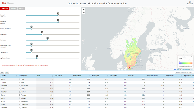
The SVA has developed a GIS tool that assesses the geographic risk of African Swine Fever (ASF) introduction to Swedish wild boars and provides numerical and visual results.
Assessing risks and making evidence-based decisisons through data analysis
Effectively assessing the risk of disease introduction requires a comprehensive understanding of the complex interactions between environmental, ecological, and demographic variables. However, collecting data that exists in various forms, processing the collected data, and analyzsing it using appropriate software is neither simple nor easy. These difficulties often hinder decision makers from making evidence-based decisions through data analysis when faced with risk.
GIS tool with numerical and visual results of data calculations
To address these challenges, we developed a GIS tool that assesses the geographic risk of African Swine Fever (ASF) introduction to Swedish wild boars and provides numerical and visual results. This tool contains data on relevant risk factors affecting the introduction of ASF, collected at 10 km by 10 km units across Sweden. Users can calculate disease risk indices without using separate software. Moreover, recognizing that the relative significance of risk factors may vary based on user expertise, the tool enables users to experiment with diverse scenarios by freely adjusting the weights of risk factors.
This tool has been developed within a research project funded by Formas. The project focuses on
- developing a tool to automatically collect data on risk factors that influence the introduction and spread of ASF, such as wild boar population and movements, environmental, climatic, and human-related activity data;
- producing ASF introduction risk maps; and
- developing a web-based tool for evaluating the spatiotemporal risk associated with ASF introduction in the Swedish wild boar population.